
The Darlene 3 Fire is now estimated to be 1,700 acres, 0% containment. The Red Cross is staffing an evacuation shelter at the La Pine High School. A Type 3 Incident Management Team will assume command of the fire Wednesday morning.
The Deschutes County Sheriff’s Office in coordination with fire managers are continuing to monitor the Darlene 3 Fire, burning southeast of La Pine. Visit deschutes.org/emergency for current evacuation area information. DCSO will continue to send out Deschutes Alerts information to those within the impacted area if evacuation levels change. For current, official Deschutes County evacuation information, visit: https://experience.arcgis.com/experience/6f8868c4477e462b8a653a89260268fc.
Central Oregon Fire Management Service firefighters responded to the Darlene 3 Fire (Incident #289) around 12:45 p.m. Tuesday afternoon. The fire started approximately one mile southeast of La Pine on the east side of Darlene Way.
The latest fire size estimate is 1,700 acres. The cause of the fire is under investigation. Responding resources include engines, handcrews, dozers, water tenders, Large Air Tankers, Helicopters, and various overhead.
Firefighters are working in coordination with dozers to establish control lines around the fire. Air resources are assisting crews by dropping retardant to slow fire spread. Firefighters are also using tactical firing operations to remove fuels ahead of the fire to establish control lines in areas where it isn’t safe to engage the fire directly due to fire behavior.
Prairie Campground, McKay Crossing Campground, Ogden Group Campground, and the Rosland OHV play area and associated trails are also closed. The Prineville District Bureau of Land Management (BLM) has also issued an Emergency Public Land Closure. The closure includes all BLM-administered lands within National Forest Road 180 on the south, Highway 97 on the west, Paulina Lake Road on the north, and the Deschutes National Forest Boundary on the east. This closure is effective immediately and will remain in effect until such a time as conditions allow for safe use of the public lands.
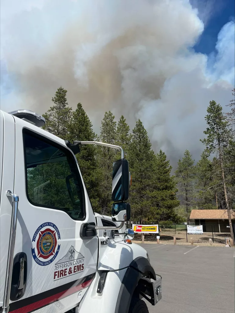
Oregon Governor Tina Kotek invoked the Emergency Conflagration Act for the Darlene 3 Fire. The governor’s declaration allows the state fire marshal to mobilize firefighters and equipment to assist local resources battling the fire. More information can be found here: https://apps.oregon.gov/oregon-newsroom/OR/OSFM/Posts/Post/darlene-three-conflagration.
For current wildfire information, the public can visit centraloregonfire.org or follow fire information on X (Twitter) @CentralORFire.